
Today, Remembrance Park is a small plot of land set apart in the southern-most part of Iowa City – a place for remembering the rich heritage we have here in Johnson County, Iowa.
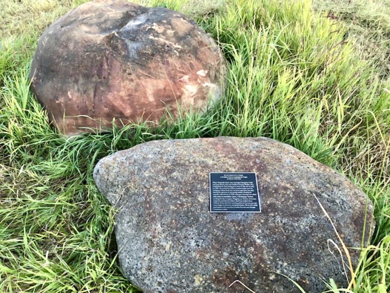

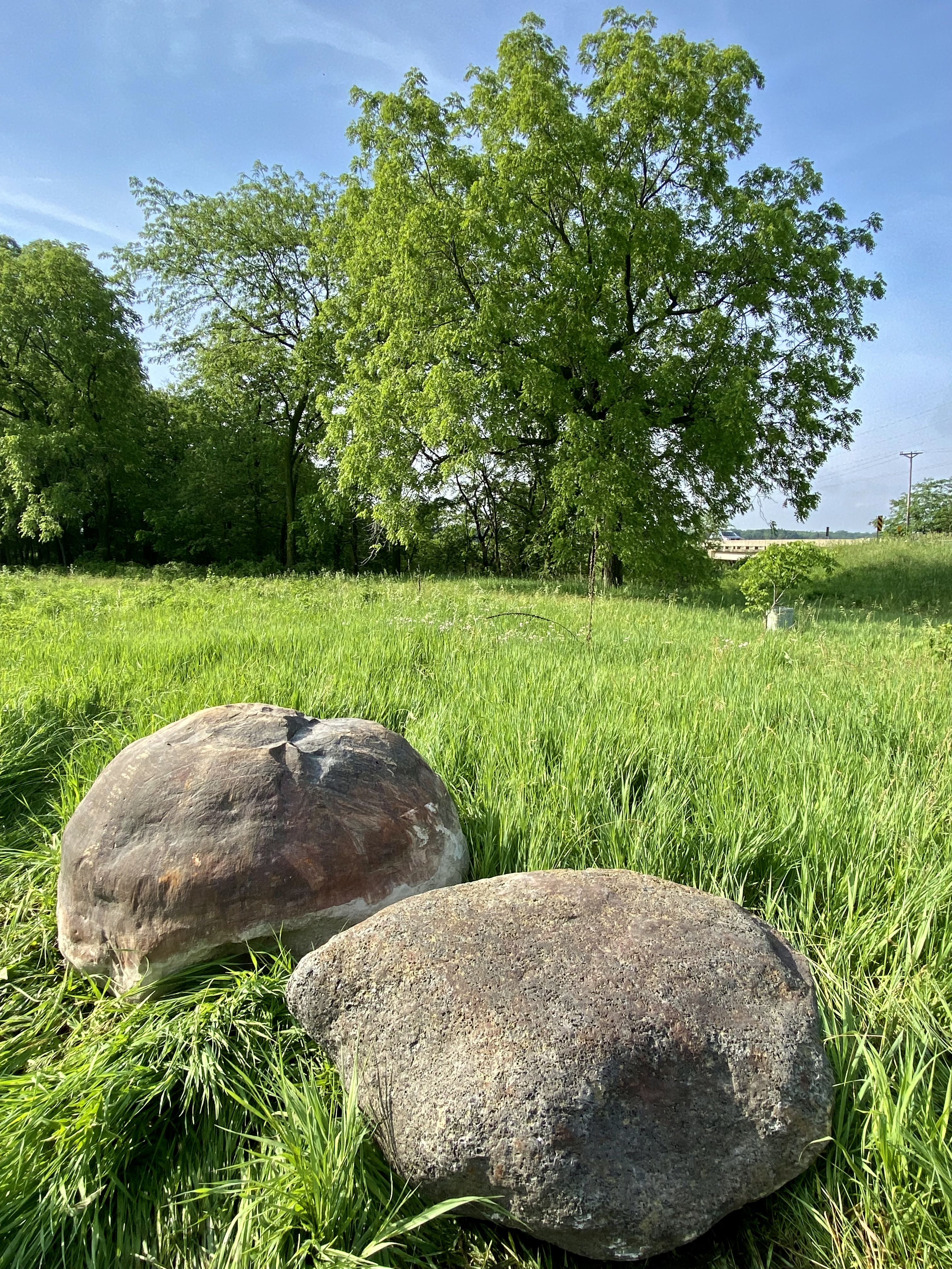
When you visit Remembrance Park, you are standing on ancient land that, literally, has thousands of years of history. Many have come before us, and sadly, we only know bits and pieces about their lives. But fortunately, we do know enough about the last 300+ years, we can share some of those details here. Let’s start with the year 1673 and progress to about 1820. This Remembrance Park Timeline includes links that will take you to additional stories we’ve assembled for your reading enjoyment…
- 1673. With the coming of the white man, Iowa’s pre-historic age ends, starting what archaeologists call Iowa’s historic age (1673-1885). (2), (3), (4), (5), (6), (7), (8)
- 1673. Father Jacques Marquette and Louis Jolliet explore the Mississippi River Valley – set foot on Iowa soil. (2)
- 1700. Descendants of the Oneota Culture, the Ioway (Báxoje) Tribe have become the primary inhabitants of eastern Iowa – including today’s Johnson County & (Sand Road) Trail. (2)
- 1701. The Meskwaki (Fox) tribe fights against the French in what is now called the Fox Wars (1712-1735). (2), (3), (4)
- 1735. Sauk and Meskwaki (Fox) tribes flee to Illinois/Iowa Mississippi River Valley, forced from Wisconsin by the French. (2), (3), (4)
- 1767. Sauk Chief Black Hawk is born in Saukenuk – near today’s Rock Island.
- 1769. Spain takes ownership of Louisiana from France.
- 1787. Meskwaki Chief Poweshiek is born in Rock River Valley of Illinois. (2), (3)
- 1781. Lead is discovered in present-day Iowa.
- 1788. Julien Dubuque arrives at Catfish Creek on the Upper Mississippi River. (2)
- 1796. Julien Dubuque acquires 189 sq. miles from Spain (Mines of Spain) for lead mining.
- 1799. Chauncey Swan, Iowa City founding father, is born in New York.
- 1801. Napoleon takes back ownership of Louisiana from Spain.
- 1803. Napoleon sells Louisiana to the United States for $15 million. (2), (3)
- 1803. Iowa becomes part of the District of Louisiana, administered by Indiana Territory, governed from St. Louis. (2), (3)
- 1804. Lewis & Clark depart St. Louis on their Louisiana Purchase expedition.
- 1804. Treaty forces the Meskwaki (Fox) & Sauk tribes out of Illinois – relocate on the Iowa side of the Mississippi River. (2), (3), (4), (5)
- 1805. Iowa becomes part of the Territory of Louisiana, with the capital in St. Louis. (2)
- 1805. Zebulon Pike and his team depart St. Louis on their expedition of the Upper Mississippi River, meets Julien Dubuque en route. (2), (3), (4)
- 1805. Stephen Sumner “Hawkeye” Phelps is born in New York. (2)
- 1808. Fort Bellevue (later called Fort Madison) is constructed in Lee County.
- 1810. Julien Dubuque dies, buried on site near Mississippi River.
- 1812. Louisiana attains statehood, Iowa becomes part of the Territory of Missouri, with the capital remaining in St. Louis. (2)
- 1816. Fort Armstrong is built upon Rock Island in the Mississippi River.
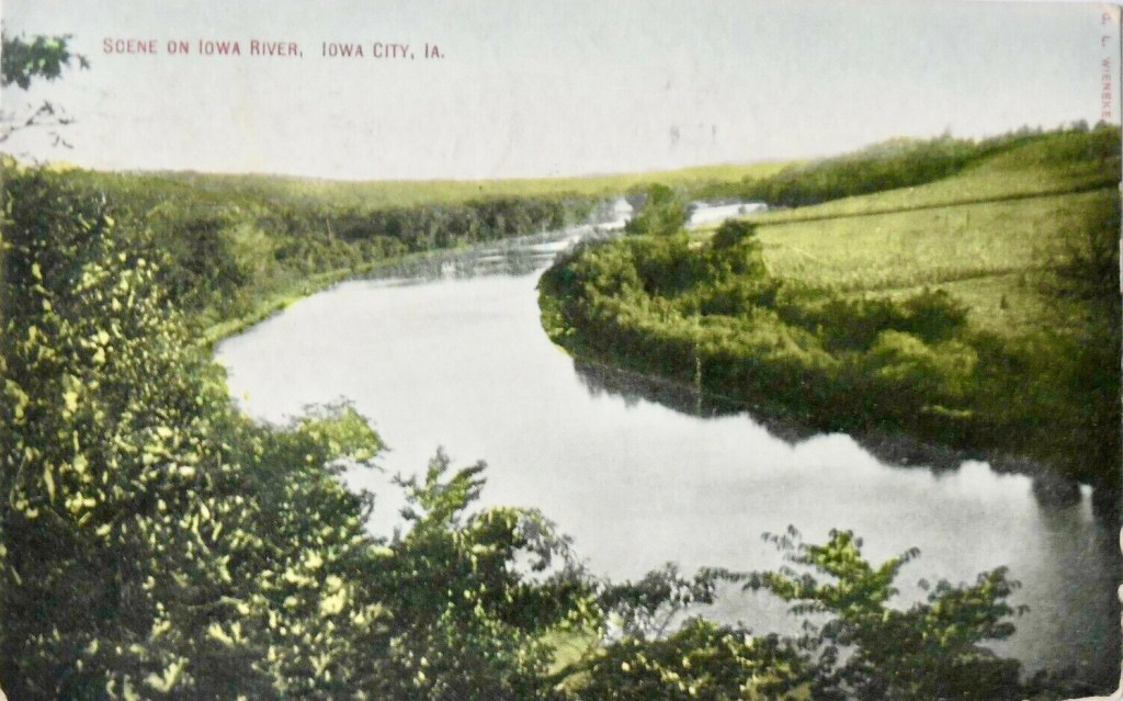
As early as the 1820’s, a handful of French fur traders explored the larger rivers of Eastern Iowa, building trading relationships with the Sauk and Fox (Meskwaki) Tribes who traversed all of, what is today, Johnson County. Two routes of transportation were available – the Iowa River and long-established Native American trails, of which today’s Sand Road was one. Now, let’s explore the years 1820 through 1832…

- 1820’s. French fur traders begin exploring eastern Iowa’s rivers.
- 1821. Missouri attains statehood – Iowa is left without official jurisdiction (“unorganized”). (2)
- 1823. The Steamboat Virginia makes the first successful trip on the Upper Mississippi River. (2), (3)
- 1825. Sumner “Hawkeye” Phelps and brothers form S.S. Phelps Fur Trading Company on the Mississippi River at Yellow Banks (Oquawka), Illinois. (2)
- 1832. The Black Hawk War ends – Sauk and Fox (Meskwaki) Tribes are forced to relocate to areas west of the Black Hawk Purchase. (2), (3), (4), (5), (6), (7), (8), (9)
- 1832. Meskwaki Chiefs Poweshiek, Wapashashiek, and Totokonock relocate camps to Iowa River Valley – Johnson County. (2), (3), (4), (5), (6), (7)
- 1832. Sumner “Hawkeye” Phelps canoes up the Iowa River to continue business with Chief Powesheik and others. (2), (3), (4), (5)
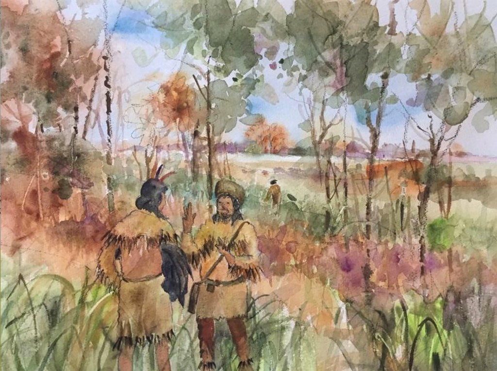
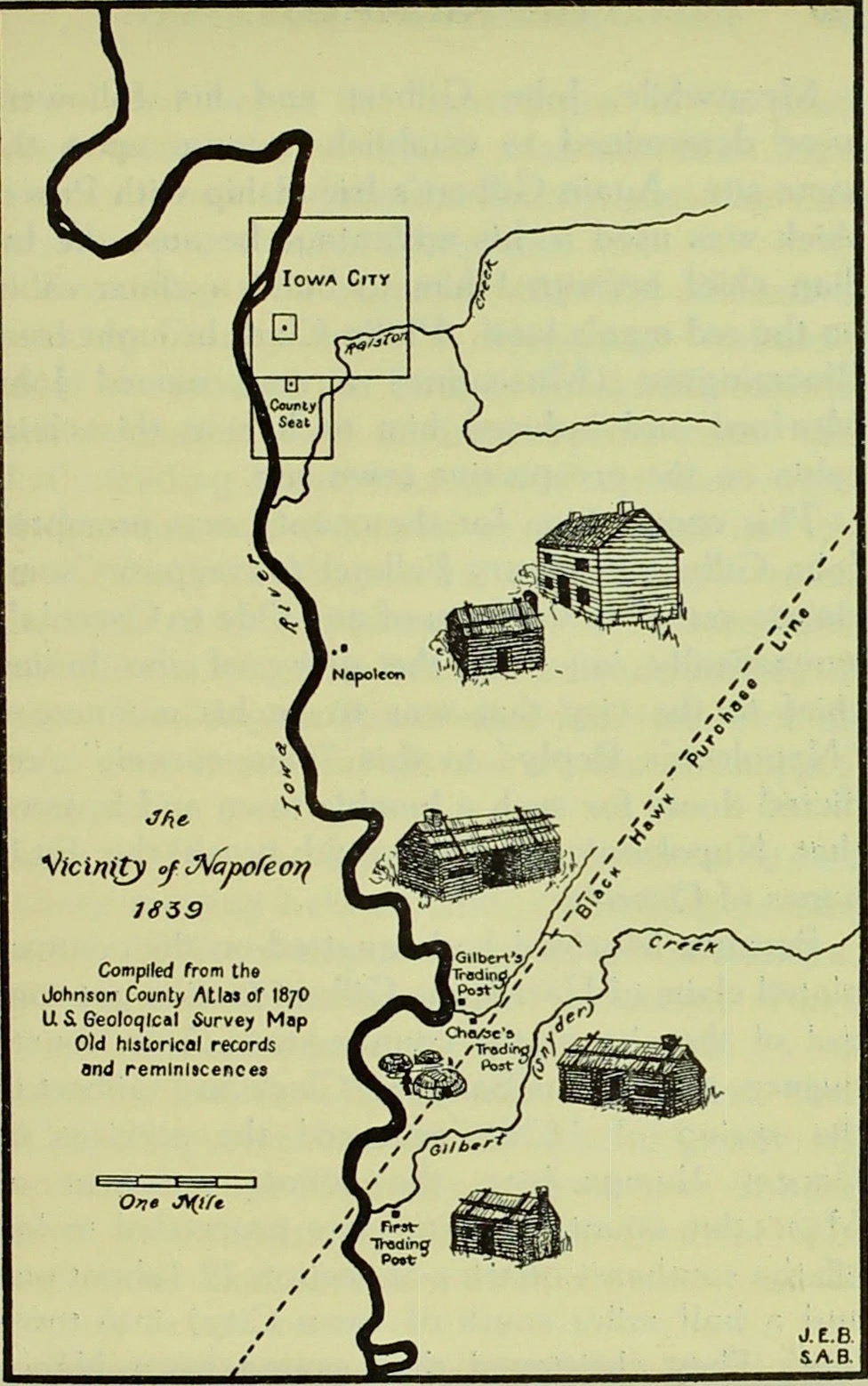
In 1832, with the Black Hawk Purchase pushing the Meskwaki people westward, the Sak & Fox people left their homes on the Mississippi River, and at least three tribes re-located to the Iowa River Valley, where you stand today. Fur trader Stephen Sumner “Hawkeye” Phelps – who had built a long-standing trading relationship with Chief Powesheik when the tribe lived on the Mississippi River – traveled here regularly to work with his friends. Phelps built a temporary Trading Post just east of the Iowa River on Gilbert/Snyder Creek.


Eastern Iowa – as we know it today – was opened to white settlers in 1833, following the 1832 Black Hawk Purchase (yellow on map above). In 1835, John Gilbert – escaping financial problems back east – moved permanently to this area to take over Phelps work, building in 1837 – a newer, larger Trading Post that was located just north of where you are standing today (see map above) – immediately across Napoleon Road. His competitor, Wheaton Chase, soon build another post very near where we are standing – just south of the little creek – which left the original post (Phelp’s) abandoned.
Johnson County was originally part of the (1836) Keokuk Reserve (green on map above) and the second (1837) Black Hawk Purchase (blue on map above) – officially becoming an Iowa county on December 21, 1837 – part of the Iowa District of Wisconsin Territory with the capital in Burlington.
- 1833. The Black Hawk Purchase is opened to white settlers. (2), (3), (4), (5), (6), (7)
- 1833. Antoine Le Claire settles on the western edge of the Mississippi River and begins calling the area IOWA – using a familiar Sauk word that means “This Is The Place”.
- 1833. Dubuque, The Key City, forms as the first white settlement in “unorganized” Iowa. (2), (3), (4)
- 1833. Burlington, City on Flint Hills, is organized on the Mississippi River.
- 1834. Iowa becomes part of the Territory of Michigan, with the capital in Detroit. (2)
- 1834. The American Fur Company buys out S.S. Phelps & Company, servicing Phelps trading post on the Iowa River. (2), (3), (4), (5)
- 1835. Albert M. Lea and his team depart Ft. Des Moines on their expedition up the Des Moines River. (2), (3), (4)
- 1835. John Gilbert (Prentice) arrives in Johnson County to oversee the American Fur Company trading post on the Iowa River. Gilbert is Johnson County’s first white settler. (2), (3), (4)
- 1836. The name IOWA is popularized by Albert M. Lea’s book/map on The District of Iowa. (2), (3), (4), (5)
- 1836. Iowa becomes part of the Territory of Wisconsin (The District of Iowa), with the capital in Belmont, Wisconsin. (2), (3)
- 1836. John King publishes Iowa’s first newspaper, The Du Buque Visitor. (2), (3)
- 1836. Chief Keokuk agrees to sell the Keokuk Reserve in a treaty at Ft. Armstrong, Illinois. (2), (3)
- 1836. Indiana farmers, Philip Clark and Eli Myers of Elkhart County, stake-out property in Johnson County, moving here in 1837. (2), (3)
- 1837. Burlington becomes the temporary capital of Wisconsin Territory.
- 1837. The Second Black Hawk Purchase is negotiated, which will force the Sauk and Fox tribes further west of Johnson County. (2), (3)
- 1837. John Gilbert leaves American Fur Company, building a larger independent trading post on the Iowa River where it serves the growing population. (2), (3), (4), (5), (6)
- 1837. Johnson County, Iowa is formed and officially recognized (Dec 21). (2), (3), (4), (5), (6)
- 1837. The United States Post Office authorizes the first stagecoach mail service in Iowa – Burlington, the Iowa Territorial capital, to St. Francisville, Missouri. (2), (3)

On January 8, 1838, John Gilbert called an organizational meeting for those who had made his little Iowa town – called Napoleon – their home. Seven people (including Gilbert) attended the meeting – Johnson County’s first business meeting – and it was held in his trading post.

- 1838. On January 8, seven pioneers gather at Gilbert’s Trading Post to plan out the future of Johnson County. Five white men, one black man (Mogawk), and one Native American woman (Jennie), working alongside three Meskwaki chiefs, make for extraordinary diversity. (2), (3)
- 1838. John Gilbert and Pleasant Harris travel to Burlington to present an expansion idea for Johnson County. Gilbert tells his Little White Lie – telling Gov. Dodge the population is 1500. (2), (3)
- 1838. Iowa becomes part of the U.S. Territory of Iowa, which includes all of present-day Iowa, Minnesota, and parts of the Dakotas. (2), (3), (4)
- 1838. L Judson and Henry J. Abel publish maps of Iowa Territory.
- 1838. Territorial Governor Robert Lucas, with personal secretary, T.S. Parvin as part of his traveling party, arrive in Burlington to take up new position. (2), (3), (4), (5)
- 1838. The Iowa Territorial Legislature meets for the first time in Burlington.
- 1838. Sauk Chief Black Hawk dies in Iowaville and is buried near the banks of the Des Moines River.
- 1838. Judge David Rorer and Burlington newspaperman, James G. Edwards, popularize the name Hawkeye for Iowans. (2), (3), (4)
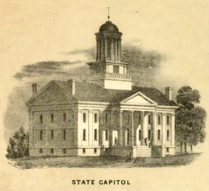
- 1838. New York ship captain Frederick M. Irish rides a horse into Iowa, arriving in Burlington. In 1838, he relocates to Iowa City, eventually working with Chauncey Swan in the early construction of the new capitol building.
- 1838. In Napoleon, John Gilbert, the small group of citizens of Johnson County, and the Meskwaki tribes join together for a festive July 4th celebration. It’s here, Chief Poweshiek offers his final blessing.
- 1838. The first county court house of Johnson County is opened in Napoleon. (2), (3), (4), (5)
- 1838. Governor Robert Lucas announces that Iowa Territory will relocate its capital from Burlington to a more centrally-located site. (2), (3), (4)
- 1838. Chief Poweshiek, his Meskwaki tribe, and others are forced to leave their camps in Johnson County. (2), (3), (4), (5), (6)

- 1839. Territorial Legislator Laurel Summers casts his vote for Iowa City – giving Governor Lucas’ plan for a new capital city in Johnson County a 13-12 victory.
- 1839. Ohio native Cyrus Sanders arrives in Iowa, first in Burlington, and later in Johnson County – writing his adventure in a journal all along the way. (2)
- 1839. John Gilbert, Iowa City’s first white settler, founder of Napoleon, and its first postmaster, dies. (2), (3), (4), (5), (6), (7)
- 1839. Iowa City’s first resident physician – Dr. Henry Murray – arrives, hangs up his shingle, and begins a 40-year-long commitment to caring for Johnson County residents.
- 1839. Iowa Territorial Commissioners Chauncey Swan, John Ronalds, and Robert Ralston are assigned to find a suitable location for the new territorial capital in Johnson County. (2), (3), (4), (5), (6), (7), (8), (9), (10)
- 1839. Johnson County settler, Philip Clark, saves the day by riding his horse to find the second commissioner needed to keep Johnson County as the host of the Territory’s new capital – and mission is accomplished on May 4th, 1839. (2)
- 1839. Iowa City is named county seat for Johnson County, first commissioners’ gathering meets in home of F.M. Irish. (2), (3), (4)
- 1839. L. Judson – first city map of Iowa City – July 4th. (2), (3), (4), (5), (6), (7), (8), (9)
- 1839. Johnson County pioneers celebrate July 4th with special city-wide gathering. (2)